| WELCOME TO LAKE MACQUARIE :: NEW SOUTH WALES LAKE MACQUARIE IS A HUGE WATERWAY, THE LARGEST FRESHWATER LAKE IN AUSTRALIA ACTUALLY, WHICH CONNECTS THE CENTRAL COAST WITH THE INDUSTRIAL CITY OF NEWCASTLE TO THE NORTH. The coastal and lake foreshore is home to kangaroos, wallabies, gliders and many birds; the water, meanwhile, shelters stingrays, dolphins and sharks. Compared to the Central Coast, the houses here appear plainer, and smaller. The atmosphere is more working class. Mining is a major industry here along with electricity generation, and smokestacks frequently mar the views. One might imagine that we have left the orbit of Sydney, and entered the embrace of Newcastle. That said, many of the houses on the foreshore have their own piers, and there is no shortage of boats. While the Central Coast has its surf lifesaving clubs, Lake Macquarie has sailing clubs and marinas, and even swimming clubs in the creeks. Accommodation is sparser and more expensive, perhaps due to a lack of competition. 
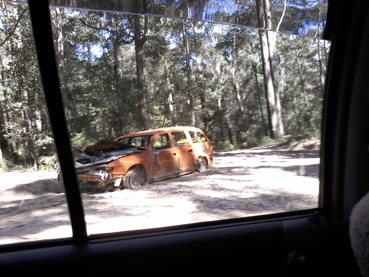
MANDALONG | 33 ° 7' S 151 ° 25' E LET'S IMAGINE we are travelling from the south to the north, the way a visitor from the Central Coast MIGHT MOVE. This is also bound to the direction I take, when the Escape from Oz finally begins. If you follow Jilliby Road through the farms and scrublands of the upper Wyong Shire, you will encounter Mandalong Road. Or rather Jilliby Road will turn into Mandalong Road, I am not sure which. One road leads to another, and the road leads ever on. On winter mornings mists lingers over the paddocks, while in autumn the trees are ablaze with rust. Getting close to Morisset, Deaves Road appears on your left, leading to Sauls Road, and ultimately Wat Pah Buddharangsee. Roads have a habit of dissolving into each other, but ultimately, all paths lead nowhere... MORISSET | 33 ° 7' S 151 ° 30' E MORISSET HAS a rather curious reputation. While local Australians might associate it negatively with the mental institute which opened here in 1909, it later became popular with foreign visitors for the wild kangaroos that can be found on its grounds. Nanny State had the last say, and the hospital was shut off with gated bridges to stop the punters from getting in. More fool Nan. As I previously mentioned, for close to 10 years I was held under virtual house arrest at my parents' property south at Lake Haven, on Budgewoi Lake. Even though Morisset was only 20km or so distant, I found it almost impossible to visit. In 2013 I had bravely caught the train which connects Wyong and Newcastle, and disembarked at Morisset. I sloshed around in the mud and rain, looking for a Buddhist temple which supposedly existed here. I was hoping it would be something like Nan Tien Temple, in the Illawarra, but it was actually fairly basic in comparison. It took nearly 10 years before my agoraphobia had recovered sufficiently enough to allow me to return to Morisset, but this time I had my heart set on finding the kangaroos which were said to congregate in huge mobs in the grounds of the Psychiatric Hospital. As it turned out, this was a rather futile gesture, as the authorities had discretely put a stop to this unauthorized caper by sealing off all access roads to the facility. It is a pity because the hospital is interesting in its own right. There is also reputed to a haunted ruins in the vicinity, with the rather ominous name of "Hospital for the Criminally Insane", and a cemetery containing unmarked graves. It made me wonder: Wouldn't it be better to capitalize on your assets when it comes to tourism, rather than shutting the whole game down? The Nanny State never ceases to amaze me with its capacity for insularity and nonsense. Nonetheless if you are interested, here is how you can reach the hospital: turn right on to Fishery Point Road just north of the town. On the way to Morisset Park you will pass Station Street (leading to Bonnells Bay) and Fishery Point Road, which passes the Bay Hotel on its way to Mirrabooka and Sunshine. (Yes, they have a suburb up here called Sunshine!) Fishery Point Road presently morphs into Morisset Park Road, and climbs a ridge. After a short distance, you will see a hospital sign on your right leading you to Silky Oaks Drive. At the end of that rather scenic drive, alongside Pourmalong Creek, you will be stopped by a roadblock from entering the tiny community which hosts the fabled kangaroos. If you're a resident, you'll get a free pass. If not, you'll have to back up, and go elsewhere. Perhaps to Cooranbong. It has a bit of history too! COORANGBONG | 33 ° 08' 151 ° 45' E BUS #280 FROM Morisset Station will take you to Cooranbong, a quaint country town in the foothills of the Watagans Mountains. Alternatively, you could drive up on Freemans Drive, which connects with Wyee Road in Morisset. It is quite a spiritual region, boasting not only a Thai temple (the Wat Pah Buddarangsee), but also a Shanti Mission Harmony Centre. My brother went to a Christian university here, Avondale College. Driving further northwest, you will soon pass Martinsville Road, and then Mount Nellinda Road on your left. Both offer access to the Watagans National Park. Freemans Drive eventually culminates in Freemans Waterhole, in the west ward of Lake Macquarie Council.  DORA CREEK | 33 ° 51' 151 ° 31' E DORA CREEK is the next stop on the railway from Morisset. The waterway from which the suburb earns its name is actually looks more like a river than a creek. On the west side of the station, Newport Road leads towards Cooranbong and Freemans Waterhole. On my last visit in 2024, I noticed work on a new housing development with magnificent views of the Eraring Power Station. One of the largest power stations in Australia, the facility is due to retired in 2030... but you never know. In fact, in May 2024 the Minns' government of NSW gave Eraring a stay of execution. Trump might extend it even further still. East of the station, a reserve stretches for a long distance, past modest dwellings. Casuarinas, paperbacks and eucalyptus trees line both banks on the journey to the lake, along with utes and speed-boats. 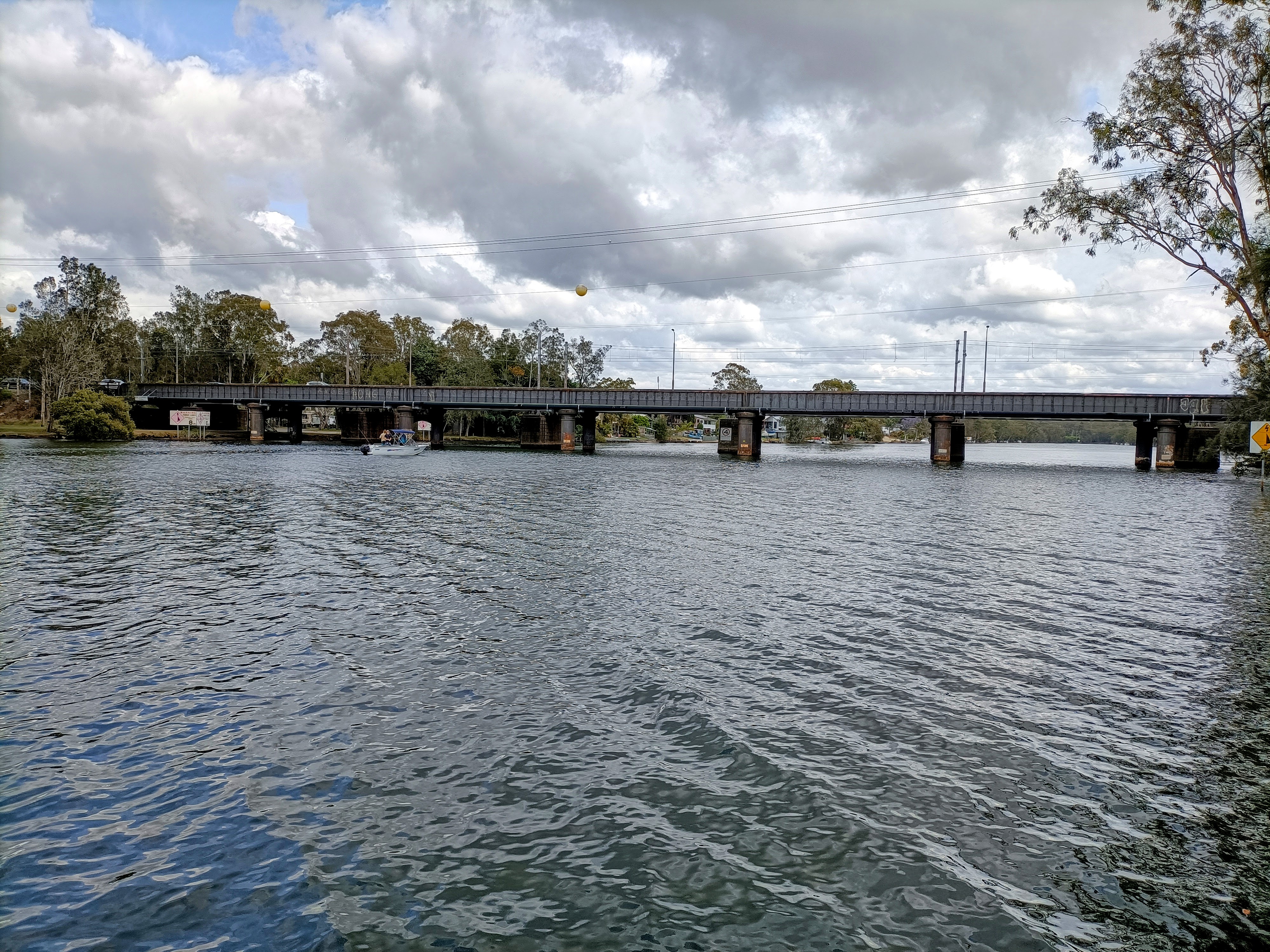 TORONTO | 33 ° 05' 151 ° 34' E AWABA, ONE railway station north of Dora Creek, is a quiet and rather hilly township, surrounded by almost untouched bush. The rocks projecting themselves out of the ground look a little different here, from the way they look in Wyong Shire: bluer and whiter. Cessnock Road passes over the railway line, whereupon it turns into Awaba Road, heading towards Toronto and Wangi Wangi. Wilton Road goes right past the railway station, leading the other way. I tried walking that way once, but found it dangerous and intimidating as there is no footpath. It is better to stick to Cessnock/Awaba Rd if you plan walking around. Over the bridge, past the electricity substation and under the Newstan-Eraring Private Coal Road overpass, you will enter Toronto. Eventually Awaba Road turns into The Boulevard, the main street of Toronto, with shops and restaurants, Coles supermarket and banks, even an eatery specializing only in schnitzels! On the foreshore of Toronto Bay, The Boulevard terminates at Victory Parade, which follows the lakeside north and south, with plenty of fine riverine architecture, most notably Toronto Hotel. All day long, CDC Hunter buses zoom by carrying passengers to Coal Point, Killaben Bay and Fassifern. Once upon a time there was a train line here too (the Toronto Branch Railway Line). The line opened in 1891, and branched off the Main Northern line at Fassifern station, crossing over a single lane tunnel on Fassifern Road, and following the shore of Fennell Bay to Blackalls Park. You can find remnants of the tracks today, rusting in the wetlands. Brighton Apartments: 157 Brighton Avenue, Toronto. Phone: (02) 9296 5707. Bookings: Book on Guest Reservations here. The fanciest place to stay in Toronto if you have the cash. Cafť Dťja Vu: 22 Victory Parade, Toronto. Phone: Menulog: Order on Menulog here. Signature dishes include fettuccine carbonara, garlic prawns, and chicken scallopini. The crumbed squid with fried prawns also looks intriguing. I would like to try the Sicilian spaghetti too, if I ever get a chance. Catalina Motel: Awaba Road, Toronto. The name Catalina seems to have some local significance, perhaps due to the seaplanes that flew from the RAAF base at neighboring Catalina Bay, across an inlet at Rathmines, all the way to Japan during the Second World War. They used to hold an annual airshow to celebrate this amphibious monoplane with retractable wing tip floats, which played a crucial role in the Pacific War. My parents attended one of those shows, but sadly they are no more. Toronto Hotel: 74 Victory Parade, Toronto. Phone: (02) 4959 1033. Website: website here. Situated on a hill overlooking Lake Macquarie, Toronto Hotel has played an important role in the history of this region. Built in 1887, it soon attracted holidaymakers, and even newly married couples used to dismount at the now abandoned railway station on Victory Parade. The complex was being renovated during my last visit, but I stayed in a concrete motel of some kind. It is not particularly beautiful from the outside, but it is comfortable enough, with thick curtains and soft carpet, and a rainfall showerhead in the bathroom. It's a Grade Four property in my ranking, with cable TV and other perks. I could have spent all day lying on the bed and watching Foxtel Movies. In January 2025 I was back again, for a total of 9 nights. I caught up with a whole marathon of 80s movies including Beverly Hills Cop and Breakfast Club. It was almost perfect. Toronto Thai Restaurant: Phone: (02) 4959 7899. Website: website here. Umi Restaurant: 2/68 The Boulevarde, Toronto. Phone: (02) 4959 8088. Website: Website here. For some reason there are not one but two Japanese restaurants in Toronto, on the same street in fact! Umi is one of them, and it boasts colorful decor and friendly staff. The long menu lists donburi, udon, and yaki udon, eel with cheese, and other delights. I ate both the donburi, and tonkotsu ramen here. The other Japanese restaurant, Mizumi, is even cooler with tablets installed at your tables, allowing you to pay for and order your meals. I chose the eel rice (unadon) when I happened to dine here in early 2025. I was soaking wet, and found the meal very warming. BOOLAROO | 32 ° 57' S 151 ° 37' E FASSIFERN SEEMS to be a quirky neighborhood, with an art gallery and the Koi Society of Australia, looking like a mini-zoo or nursery. This kind of quirkiness extends all the way to Booragul, which is home to the Museum of Art and Culture (Yapang), featuring totem poles and statues hidden in the mangroves. Macquarie Road (can you guess how this street got its name?) skirts one segment of the lake from Fassifern to Fennell Bay, whereupon it changes into Bay Road, at the traffic lights. Yes sirree, every second geographical feature up here features a ďbayĒ or ďpointĒ somewhere! Bus #269 and #270 stop here on their way from Toronto to Charlestown via Teralba, Booragul, and then Nord Street in Speers Point. Into Marmong Point, sweeping views of the northernmost stretch of the lake present themselves. This stretch is known as Cockle Bay. The Five Islands is a patch of mangroves at the northwest edge of the lake, marking where Cockle Creek enters. Toronto Road turns into Five Islands Road as it bears its way towards Wallsend and Newcastle. Boolaroo Station lies on the other side of the roundabout; Teralba Station is a little further north. The lake reaches its most northerly tip at Speers Point, near Teralba. Thompson Road presents outstanding views of the lake's shore and western hills, as it climbs Munibung Hill. Main Road connects Speers Point and Boolaroo, passing the Lake Macquarie Council chambers. It comes to an end near Cockle Creek railway station. The Esplanade, on the other hand, runs from Speers Point to Warners Bay. It is a long but scenic walk, following the bends and turns of the lakeside. On warm sunny days, locals can be seen running or exercising on the Watagans Cycle Track. Great Northern Hotel: 2 Anzac Parade, Teralba. Phone: (02) 4911 2399. Website: website here. As in Toronto, they love their schnitzels here: the Chuck Norris Challenge involves beef mince, twice-smoked bacon, liquid cheese and gravy. It is located off York Street, opposite the train station. There is also a bus stop here, allowing you access to Glendale and Boolaroo. Mama Ally: 192 The Esplanade, Speers Point. Phone: 0422 197898. Filipino cafe, open daily from 6am to 2pm-ish. I ordered an iced coffee and the tapsilog (beef and eggs with garlic rice). As well as tapsilog, Mama also serves longsilog (featuring pork instead of beef) and bacsilog (using bacon). And also chiksilog (can you imagine what meat is employed here?) In the desserts department, they have halo halo (shaved ice with condensed milk, mung and kidney beans, purple yams and so on). Museum of Art and Culture Lake Macquarie/Yapang: 1A First Street, Booragul. Website: website here. Opening Hours: 9am-3pm Tuesday to Sunday. Free entry, with many of its exhibits located outdoors. Entering the museum complex, by the site of the historic Awaba House, you pass Jamie Northís cast-concrete sculptures which are said to "partner the natural and the industrial in a poetic relationship". Awabakal Dreaming is a mosaic detailing Biame, one of the great Goori ancestral beings of the creation period. It includes symbols of the local environment in the style of the petroglyphs (rock engravings) found in Mt Yango. Pippi's at the Point Hotel: 199 Main Road, Speers Point. Phone: (02) 4958 1022. Website: website here. Another storied venue, like Awaba House or the Great Northern Hotel, and a potential Grade Three or Four property here, close to $160 per night, although rewards can bring it down a tad. I booked a stay for three weeks in November 2025, and was amazed. It could easily be the best place I ever stayed. The bathroom is fitted with a wide rainfall showerhead. The TV was even wider, with a wide selection of options, and was high res. Old episodes of The Sopranos looked much clearer here than they did on my TV in Shinozaki, in Japan, during the golden age of television. Newer episodes of River Monsters knocked it out of the park. Housekeeping was discrete and had usually finished before 12pm, allowing me to make more use of my time. The ice box in the bar fridge was icy cold, and the carpet was soft. The best thing of all, however, was that the rooms have their own balconies! It was a nice place to sit down and enjoy some cold cooking. I loved the balcony a little too much... I got locked out of my room there on my second last night! Table 1 Espresso: Shop 2/450 The Esplanade, Warners Bay. Phone: (02) 4948 1115. Website: website here. Located in the heart of Speers Point Park, near the swimming pool. The breakfast menu features Moroccan style scrambled eggs on toasted sourdough. WARNERS BAY | 32 ° 58' S 151 ° 39' E WHEN it comes to anxiety, Warners Bay is the mythical inflection point. Regardless of which side of the lake I travel to reach it, it is equidistant from my mother's house on the Central Coast. Following the Old Pacific Highway via Swansea and Belmont, it is 54km from Wyong. If I do the inland route in the same order as is detailed in this guide, it is 56km or so. If I continued orbiting the lake in either direction, I would actually start returning closer to home, so my anxiety should reduce. At least that's the theory... I haven't been able to ascertain it in real life.  East of Warners Bay, the aforementioned Watagans Cycle Track continues its journey towards Eleebana. There is a bridge of some kind down here, or at least an elevated pathway over the water (in other words, South Creek.) It is aptly named: from this point we are moving south again, in our orbit of the lake. Beyond Eleebana, Valentine is the next point before Belmont, supposedly 13km from Speers Point, but only 40km from Wyong (if you take the coastal route). Dull Boys Social Co: Hillsborough Road, Warners Bay. Website: website here. A favourite of Garnet Mae and his family, who also enjoyed the indoor go karts next door. The Esplanade Motel: 568 The Esplanade, Warners Bay. Phone: (02) 4948 9666. Website: website here. Classic oldschool motel, which is said to be a good place to watch the sunset over the lake. Boasts a teppenyaki restaurant serving grilled Japanese food. Warners at the Bay: 320 Hillsborough Road, Warners Bay. Phone: (02) 4956 6066. Website: website here. It has a bottleshop which I can and will make use of. The pub restaurant serves Moreton Bay Bug (flathead lobster) mac and cheese, Mediterranean lamb pizza, Indian beef korma and other delights. There is also a full range of schnitzels. .. Bus #266 patrols the Cardiff area. Argenton Hotel is only $93 per night... CHARLESTOWN | 33 ° 04' S 151 ° 66' E WHILE SPEERS POINT is the council seat, Charlestown is the largest settlement in the Lake Macquarie region, with a population of 13,000 souls. It hosts a huge suburban shopping mall, oodles of hotels and executive apartments, as well as restaurants and the like. There is a hotel at Gateshead with rooms costing only $90 on a weeknight, and it has private bathrooms and cable TV. BELMONT | 33 ° 04' S 151 ° 66' E LIKE MANY places on Lake Macquarie, this suburb is synonymous with sailing. There are a number of marinas: at Marks Point, on Ada Street, and then there is the Belmont 16s on The Parade... Belmont 16s: Website: website here. Belmont Yacht Club: Ada Street, Belmont. Website: website here.. 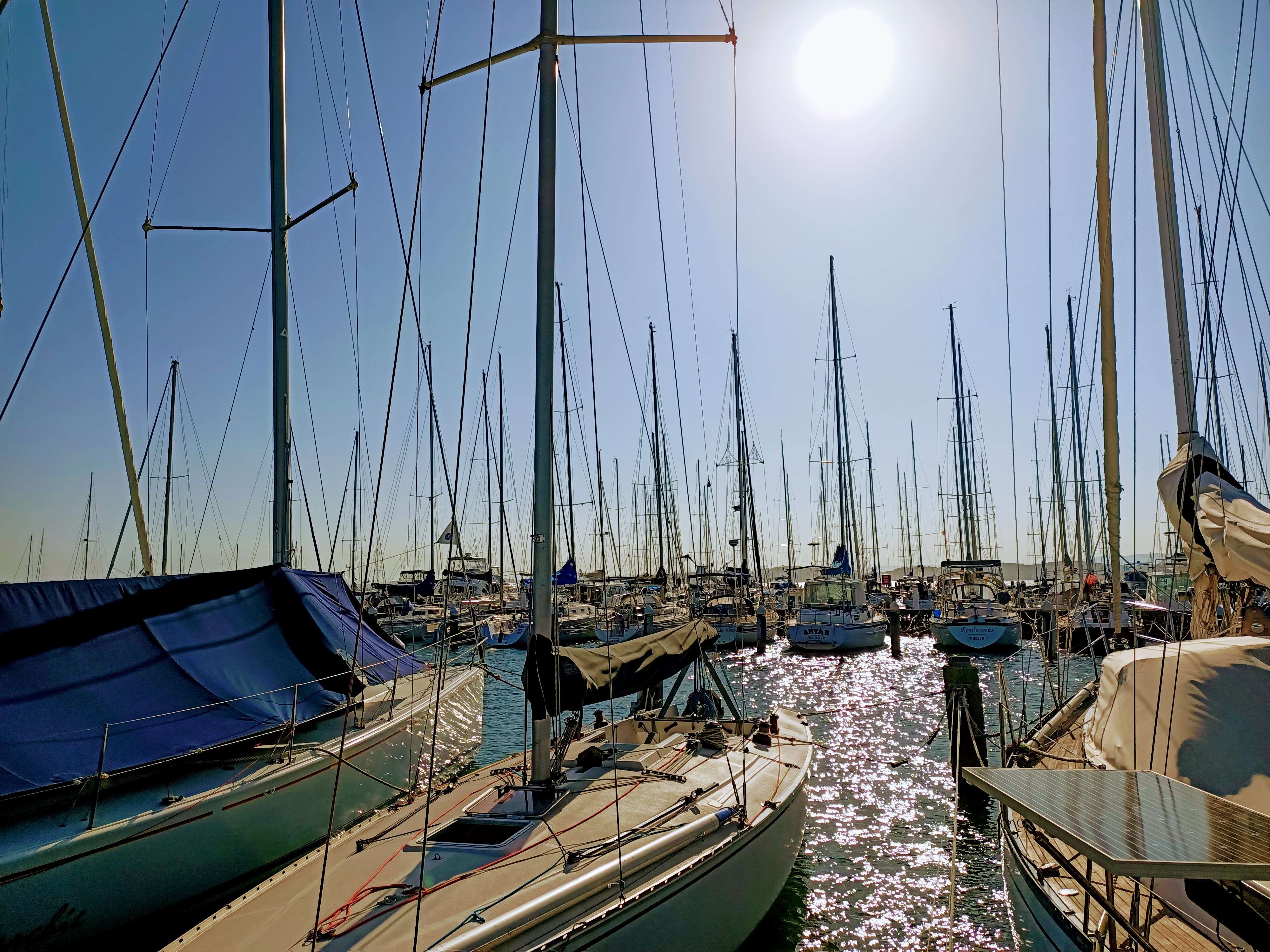 I was made aware of this facility by one of the volunteers at Starett Lodge, but it wasn't until 2020 that I was recovered enough to make it there. ... I finally made it here for my 47th birthday. There is just one place to eat, Crusoe's on the Lake, but it is quality. I ate filet mignon, which was divine. Coming home, I heard something on the news about a new disease going viral in China.  SWANSEA IN days of the Awabakal Aborigines who used to live here, this area was called Galgabba. It was said to be an ideal place to live with plenty of sea and freshwater fish, birds and animals to sustain upon. When the white fellas came they named it Pelican Flats (can you imagine why?) The present rather more genteel and pretentious name Swansea didn't come about until 1887 following the e ab Unlike a lot of other places described in this guide, Swansea has a beach as well as lake. Visit Caves Beach at low tide to see what I mean! 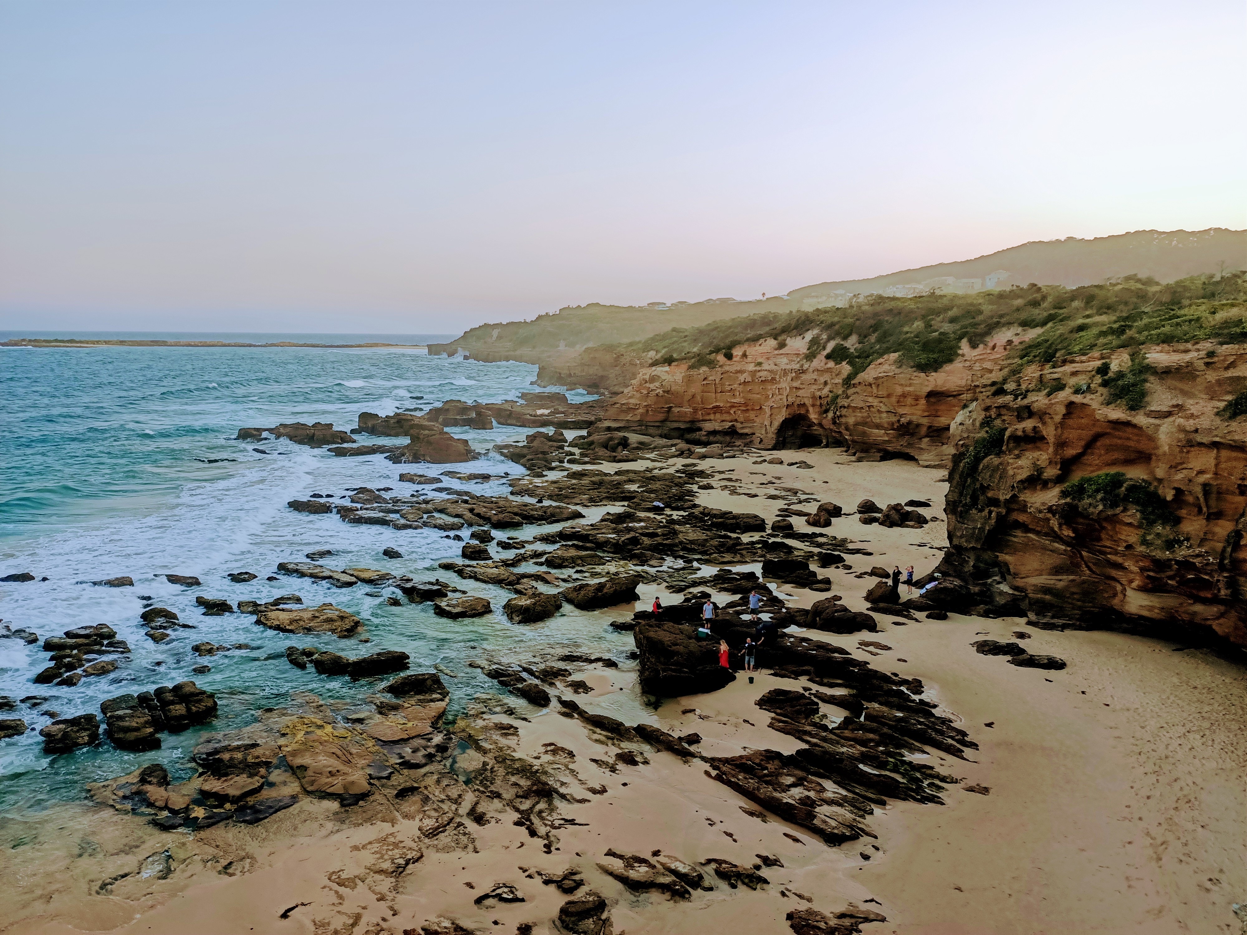 Nearby you can see Spoon Rocks, constructed to transport coal on to nearby ships. Stay at the Swansea Motel, next to a bus stop on the Old Pacific Highway, south of the bridge! There is a McDonald's a short walk inland, which might suit me if I am hungry between lessons! Drink at Swansea Hotel. Buses #91 and #99 connect Lake Haven with Swansea via the Pacific Highway; number #29 goes from Swansea North to Warners Bay. If you are heading south, you can stop at some other attractions like Catherine Hill Bay. Churchill's B&B Spa: On Airbnb.CATHERINE HILL BAY 00" height="240" align="right"> THIS IS NOT ONLY ONE OF THE MOST BEAUTIFUL AND WILD AND PHOTOGENIC PARTS OF THE CENTRAL COAST, BUT IT IS ALSO A PLACE STEEPED IN THE WORKING CLASS HISTORY OF THE 19th century. The village is named after the Catherine Hill, a schooner wrecked here in 1867. Coal was discovered and mined by the New Wallsend Company which bought up the land, built a jetty and opened the mine in 1873. Back in those glory days about 1000 tons of coal a week were taken by horse-drawn skips from the mine to a loading chute on the jetty. That has all faded today -- but to my mind, there is nothing more enchanting than ghostruins from the past. Especially anywhere near the coast with its frequent salty gusts, any ruin is priceless. And Catherine Hill Bay is a ruin. Of a very friendly kind. The Sydney Morning Herald said thus about Catherine Hill Bay: "Catherine Hill Bay is a quiet old mining village within the City of Lake Macquarie, 119 km north of Sydney via the Newcastle Freeway and the Pacific Highway. Despite the beauty of the bay and its attractive situation in a valley surrounded by high hills and bushland the presence of the rusty iron and lifeless machinery inevitably colours the visitor's perspective of the bay. Certainly Catherine Hill Bay has a very different feel to the gay, busy tourism-based towns of the Central Coast. "The village is named after the Catherine Hill, a schooner wrecked here in 1867. Coal was discovered and mined by the New Wallsend Company which bought up the land, built a jetty and opened the mine in 1873. The coastal location facilitated shipment and avoided the bar at the entrance to Lake Macquarie." The last time I was there I took this photo from the nearby Munmorah National Park, which is a fabulous place with a retro Aussie beach holiday vibe. While we were there, watching the crows battle eagles in the sky, we were treated to an inpromptu flyover by Australian Air Force jets from the nearby air base. It seemed to be a particularly popular place for fishermen of all nationalities, and the seas off the rocks looked lethally strong and dangerous. Bulk carriers sat patiently off the shore, waiting for their turn to fill up on black gold at the world's largest coal port, at nearby Newcastle. CAVES BEACH
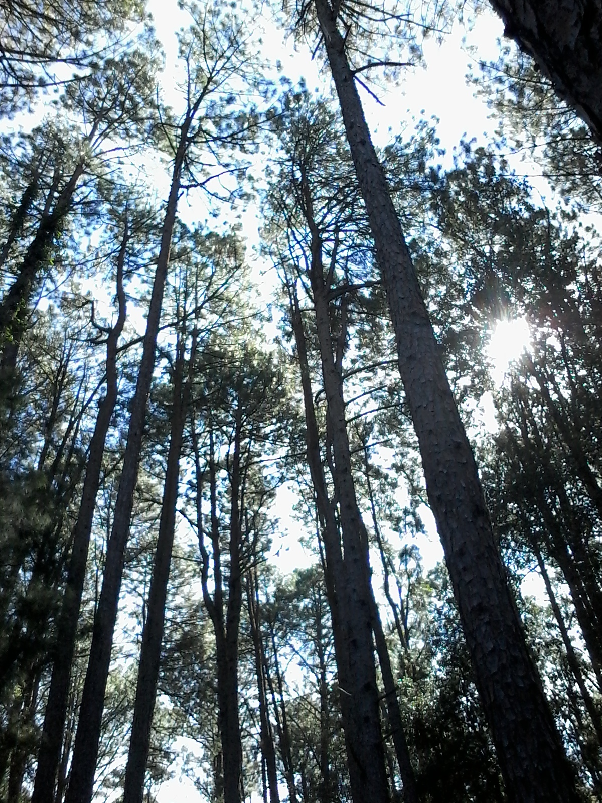
SWANSEA In the days of who used to live here, this area was called Galgabba. It was MURRAYS BEACH The land originally SUMMERLAND POINT  WHILE TECHNICALLY being part of the Central Coast, the twin suburbs of Summerland Point and Gwandalan hug the southern foreshore of Lake Macquarie. The powerful owl resides here, and there is an Institute of Sport facility too. Boats (including one houseboat!), blue water, blue skies... distant realms, it is always interesting for me to go back there, and recall past days. As places go, it is a nice place to base yourself, if you want to dream of other worlds. YARRAMALONG | THE YARRAMALONG VALLEY OPENS LIKE A FRACTAL IN THE NORTH-WEST PART OF THE WYONG SHIRE... p://www.treetops.com.au/"in the Ourimbah State Forest. Iay.com.au/">lar wedding venue. While kids might bcom/wikiloc/view.do?id=1672078">omplete the Ourimbah State Forest Loop. Thipy Valley" territory, and one mighillegal Rave party while wandering around. is is just on Bondi Beach has its ll on Campbell Pde, Thrusday-Sunday, rd.com WYEE | The Wyee Nursery is said to be a good place to relax. They have conifers and talking cockatoos.
hire me - privacy policy - - Carnarvon Gorge - Roma - Woolgoolga - - Wollongong
|
| |||||||||